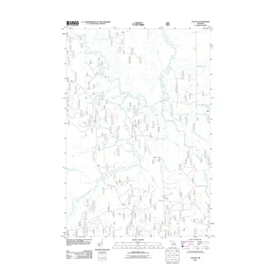
2011 Map of Choate
USGS Topo · Published 2011About this map
Choate serves as the focal settlement in this northern Michigan wilderness, where the landscape is defined by the complex convergence of the South Branch Ontonagon River and the Cisco Branch Ontonagon River. The topography is etched by an intricate network of drainage, including Tenmile Creek, Twomile Creek, and Sucker Creek, which flow through the dense forest lands of Ontonagon County. Along the Cisco Branch, Wolverine Falls stands as a notable natural landmark amidst the timber-rich terrain. Transportation in this era relies heavily on a grid of managed forest routes such as Forest Hwy 6930 and Forest Hwy 6950, alongside local tracks like Amber Lake Rd and Sleepy Hollow Rd. To the northeast, the quiet waters of Steusser Lake and the uniquely named Redlight Creek highlight the remote character of this Upper Peninsula interior.
Find a feature on this map
20 named features on this map. Tap any name to fly to it.
Don’t see what you’re looking for? This feature index may not catch every label — zoom into the map to look around manually.
Map Details
Editions of this 2011 Choate Map
This is the sole edition of this map. No revisions or reprints were ever made.
Other maps of this area

1949 · Rockland
USGS Topo · 1:62,500

1951 · Rockland
USGS Topo · 1:62,500

1952 · Watersmeet
USGS Topo · 1:62,500

1952 · Thayer
USGS Topo · 1:62,500

1956 · Matchwood
USGS Topo · 1:62,500

1958 · Iron River
USGS Topo · 1:250,000

1960 · Iron River
USGS Topo · 1:250,000

1961 · Iron River
USGS Topo · 1:250,000

1967 · Iron River
USGS Topo · 1:250,000

1979 · Ontonagon
USGS Topo · 1:100,000
Featured Places
- McMillan Township, MI
- Marenisco Township, MI
- Haight Township, MI
- Gogebic County, MI
- Ontonagon County, MI