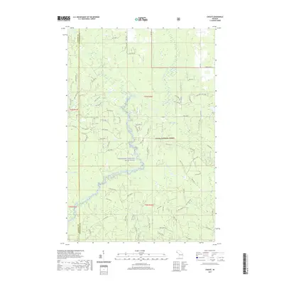
2019 Map of Choate
USGS Topo · Published 2019About this map
The Ontonagon Wild and Scenic River and its numerous tributaries dominate this reach of the Ottawa National Forest. The landscape is defined by a dense network of watercourses, including the South Branch Ontonagon River and the Cisco Branch Ontonagon River, which draw from the surrounding wetlands and creeks like Tenmile Creek and Sucker Creek. The settlement of Choate appears as a focal point for the forest service road system, which includes named routes such as Choate Rd and Belisle Rd. Navigation through this timbered region is marked by natural features such as the Eighteen Mile Rapids, while the boundary between Gogebic and Ontonagon counties bisects the western portion of the map. The intricate system of Forest Service trails, such as Nfst-6987, indicates the managed nature of this wilderness at the time of this 2019 survey.
Find a feature on this map
78 named features on this map. Tap any name to fly to it.
Don’t see what you’re looking for? This feature index may not catch every label — zoom into the map to look around manually.
Map Details
Editions of this 2019 Choate Map
This is the sole edition of this map. No revisions or reprints were ever made.
Other maps of this area

1949 · Rockland
USGS Topo · 1:62,500

1951 · Rockland
USGS Topo · 1:62,500

1952 · Watersmeet
USGS Topo · 1:62,500

1952 · Thayer
USGS Topo · 1:62,500

1956 · Matchwood
USGS Topo · 1:62,500

1958 · Iron River
USGS Topo · 1:250,000

1960 · Iron River
USGS Topo · 1:250,000

1961 · Iron River
USGS Topo · 1:250,000

1967 · Iron River
USGS Topo · 1:250,000

1979 · Ontonagon
USGS Topo · 1:100,000
Featured Places
- McMillan Township, MI
- Marenisco Township, MI
- Haight Township, MI
- Gogebic County, MI
- Ontonagon County, MI