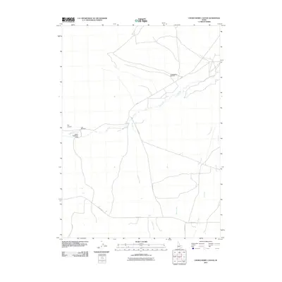
2010 Map of Chokecherry Canyon
USGS Topo · Published 2010About this map
The Upper Raft River Valley occupies this high basin of Southern Idaho, where the Raft River winds through a landscape carved by distinct geographical features. The northern reaches are dominated by Chokecherry Canyon, while the western boundary is defined by the sharp transition of The Narrows and the adjacent Dry Canyon. This topography dictates the drainage patterns of the region, with several seasonal and perennial streams like Onemile Creek, Barnes Creek, and Holt Creek flowing toward the central river system.
Find a feature on this map
13 named features on this map. Tap any name to fly to it.
Don’t see what you’re looking for? This feature index may not catch every label — zoom into the map to look around manually.
Map Details
Editions of this 2010 Chokecherry Canyon Map
This is the sole edition of this map. No revisions or reprints were ever made.
Other maps of this area

1954 · Pocatello
USGS Topo · 1:250,000

1954 · Brigham City
USGS Topo · 1:250,000

1958 · Pocatello
USGS Topo · 1:250,000

1958 · Brigham City
USGS Topo · 1:250,000

1959 · Park Valley
USGS Topo · 1:62,500

1959 · Yost
USGS Topo · 1:62,500

1962 · Brigham City
USGS Topo · 1:250,000

1968 · Jim Sage Canyon
USGS Topo · 1:24,000

1968 · Elba
USGS Topo · 1:24,000

1968 · Kane Canyon
USGS Topo · 1:24,000