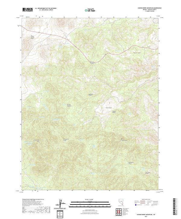
2021 Map of Chokecherry Mountain
USGS Topo · Published 2021About this map
Burnt Springs Range and the Delamar Mountains define this high-desert topography in Lincoln County. The landscape is characterized by a dense network of water sources, including Nelson Spring, Oak Spring, and Mule Spring, which historically supported movement through these basins. High points such as Oak Springs Summit and Chokecherry Mtn rise above deep drainages like Hardy Canyon and Colburn Canyon. The presence of the Taylor Mine Canyon and Taylor Mine Spring suggests the region's historical connection to early 20th-century prospecting. Unusual naming conventions, such as the Balm of Gilead Canyon and Monkey Wrench Wash, hint at the diverse cultural influences and local lore of the settlers and miners who traversed this arid terrain.
Find a feature on this map
43 named features on this map. Tap any name to fly to it.
Don’t see what you’re looking for? This feature index may not catch every label — zoom into the map to look around manually.
Map Details
Editions of this 2021 Chokecherry Mountain Map
This is the sole edition of this map. No revisions or reprints were ever made.
Other maps of this area

1885 · Pioche
USGS Topo · 1:250,000

1886 · Pioche
USGS Topo · 1:250,000

1954 · Caliente
USGS Topo · 1:250,000

1959 · Caliente
USGS Topo · 1:250,000

1969 · Delamar
USGS Topo · 1:24,000

1969 · Elgin NE
USGS Topo · 1:24,000

1969 · Slidy Mountain
USGS Topo · 1:24,000
1970 · Pahroc Spring SE
USGS Topo · 1:24,000
1970 · Pahroc Spring NE
USGS Topo · 1:24,000
1970 · Caliente NW
USGS Topo · 1:24,000