
1969 Map of Delamar
USGS Topo · Published 1972About this map
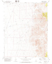
Delamar stands as a focal point in the late 1960s, its former industry marked by a series of Mine workings, Tailings, and surviving Ruins. Located within the broader Delamar Valley, this area reveals the footprint of a high-desert mining district, including a small Cem and the secondary site of Helene to the north. The landscape is deeply incised by a network of drainage channels such as Monkey Wrench Wash, Helene Wash, and Delamar Wash, which converge from the slopes of Big Lime Mountain.
Find a feature on this map
20 named features on this map. Tap any name to fly to it.
Don’t see what you’re looking for? This feature index may not catch every label — zoom into the map to look around manually.
Map Details
Editions of this 1969 Delamar Map
2 editions found
Other maps of this area

1885 · Pioche
USGS Topo · 1:250,000

1886 · Pioche
USGS Topo · 1:250,000

1954 · Caliente
USGS Topo · 1:250,000

1959 · Caliente
USGS Topo · 1:250,000

1969 · Gregerson Basin
USGS Topo · 1:24,000

1969 · Slidy Mountain
USGS Topo · 1:24,000

1969 · Delamar NW
USGS Topo · 1:24,000
1969 · Delamar Lake
USGS Topo · 1:24,000

1969 · Elgin SW
USGS Topo · 1:24,000
1970 · Pahroc Summit Pass
USGS Topo · 1:24,000