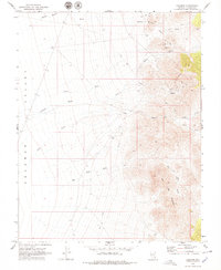
1969 Map of Delamar
USGS Topo · Published 1979About this map
Delamar and the nearby settlement of Helene serve as the primary focal points of this 1969 Lincoln County survey, documenting a landscape deeply shaped by mining activity. Evidence of industrial heritage is scattered throughout the eastern foothills, including a marked Mine, extensive Tailings, and several Ruins. The presence of a Cem near Helene and another north of Delamar underscores the historical permanence of these desert communities during their active years.
Find a feature on this map
19 named features on this map. Tap any name to fly to it.
Don’t see what you’re looking for? This feature index may not catch every label — zoom into the map to look around manually.
Map Details
Editions of this 1969 Delamar Map
2 editions found
Other maps of this area

1885 · Pioche
USGS Topo · 1:250,000

1886 · Pioche
USGS Topo · 1:250,000

1954 · Caliente
USGS Topo · 1:250,000

1959 · Caliente
USGS Topo · 1:250,000

1969 · Delamar
USGS Topo · 1:24,000

1969 · Gregerson Basin
USGS Topo · 1:24,000

1969 · Slidy Mountain
USGS Topo · 1:24,000

1969 · Delamar NW
USGS Topo · 1:24,000
1969 · Delamar Lake
USGS Topo · 1:24,000

1969 · Elgin SW
USGS Topo · 1:24,000