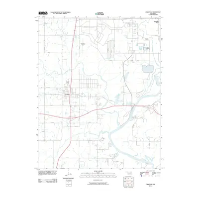
2010 Map of Chouteau
USGS Topo · Published 2010About this map
Chouteau and the surrounding Mayes County landscape are defined by the convergence of several major waterways, most notably the Neosho River and Pryor Creek. This 2010 survey illustrates a region where significant industrial infrastructure, such as the Mid-America Industrial Airport, exists alongside deep-rooted local history. The map is particularly useful for genealogists and local historians, as it clearly identifies several family and community burial sites including Alberty Cemetery, Sixkiller Cemetery, and the Chouteau Cemetery. Settlement patterns are concentrated around the primary intersection of US Hwy 412 Alt and the north-south highway corridor, with residential developments like Sportsmen Acres appearing to the northeast. Beyond the transit hubs, the terrain is marked by the winding paths of Chouteau Creek and Brush Creek, and the community space at Camp Christian, showcasing the balance between the area's natural riverine geography and its modern industrial and residential growth.
Find a feature on this map
45 named features on this map. Tap any name to fly to it.
Don’t see what you’re looking for? This feature index may not catch every label — zoom into the map to look around manually.
Map Details
Editions of this 2010 Chouteau Map
This is the sole edition of this map. No revisions or reprints were ever made.
Other maps of this area

1896 · Pryor
USGS Topo · 1:125,000

1901 · Pryor
USGS Topo · 1:125,000

1954 · Tulsa
USGS Topo · 1:250,000

1958 · Tulsa
USGS Topo · 1:250,000

1963 · Tulsa
USGS Topo · 1:250,000
1963 · Neodesha
USGS Topo · 1:24,000
1970 · Osage Hills
USGS Topo · 1:24,000
1970 · Chouteau NW
USGS Topo · 1:24,000
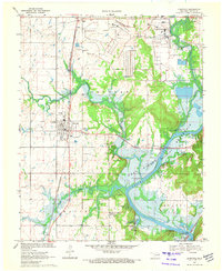
1970 · Chouteau
USGS Topo · 1:24,000
1970 · Rocky Point
USGS Topo · 1:24,000