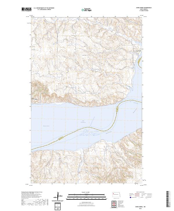
2024 Map of Chris Creek
USGS Topo · Published 2024About this map
Lake Sakakawea dominates the southern landscape of this modern North Dakota survey, where the massive reservoir occupies the former path of the Missouri River. The boundary between Williams County and McKenzie County follows the centerline of this water body, tracing a submerged history of the river valley. North of the lake, the terrain is characterized by a series of drainages, including the aptly named Halfbreed Creek, Chris Creek, and Long Creek, which carve through the high prairie toward the reservoir.
Find a feature on this map
18 named features on this map. Tap any name to fly to it.
Don’t see what you’re looking for? This feature index may not catch every label — zoom into the map to look around manually.
Map Details
Editions of this 2024 Chris Creek Map
This is the sole edition of this map. No revisions or reprints were ever made.
Other maps of this area

1911 · Ray
USGS Topo · 1:125,000

1953 · Williston
USGS Topo · 1:250,000

1953 · Watford City
USGS Topo · 1:250,000

1957 · Williston
USGS Topo · 1:250,000

1957 · Watford City
USGS Topo · 1:250,000

1967 · Watford City
USGS Topo · 1:250,000

1969 · Cussicks Spring
USGS Topo · 1:24,000

1978 · Lake Jessie
USGS Topo · 1:24,000

1978 · Watford City NW
USGS Topo · 1:24,000

1978 · Watford City NE
USGS Topo · 1:24,000