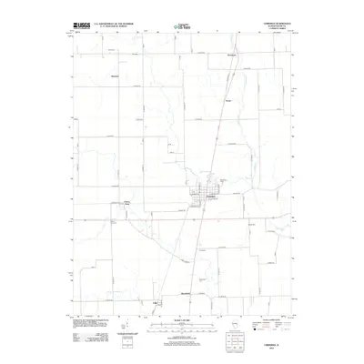
2012 Map of Chrisman
USGS Topo · Published 2012About this map
Chrisman serves as the central hub of this eastern Illinois landscape, where the local street grid including W Monroe Ave and E Lincoln Ave meets a regional network of rural section-line roads. The area is defined by its deep agricultural roots and a legacy of small, family-named settlements like Mortimer, Woodyard, and Scotts. A strong genealogical record is preserved across the terrain, with numerous burial sites such as Woodland Cem, Hoult Cem, and Bloomfield Cem positioned near the headwaters of Crabapple Cr and S Fork Brouilletts Cr. Further south, the community of Edgar sits near the tracks, while Cherry Point and its associated Cherry Point Cem highlight the scattered hamlets that historically supported the local farming economy during the early twenty-first century.
Find a feature on this map
35 named features on this map. Tap any name to fly to it.
Don’t see what you’re looking for? This feature index may not catch every label — zoom into the map to look around manually.
Map Details
Editions of this 2012 Chrisman Map
This is the sole edition of this map. No revisions or reprints were ever made.
Other maps of this area

1946 · Kansas
USGS Topo · 1:62,500

1947 · Ridge Farm
USGS Topo · 1:62,500

1947 · Paris
USGS Topo · 1:62,500

1949 · Kansas
USGS Topo · 1:62,500

1949 · Paris
USGS Topo · 1:62,500

1951 · Saint Bernice
USGS Topo · 1:24,000

1953 · Indianapolis
USGS Topo · 1:250,000

1955 · Humrick
USGS Topo · 1:24,000

1955 · Scottland
USGS Topo · 1:24,000

1956 · Indianapolis
USGS Topo · 1:250,000