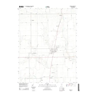
2015 Map of Chrisman
USGS Topo · Published 2015About this map
Chrisman serves as the central hub for this portion of Edgar County, where a grid of rural roads connects several small communities and historical family landmarks. The landscape is defined by agricultural fields punctuated by small settlements like Woodyard, Mortimer, and Bloomfield. Watercourses such as Crabapple Cr and S Fork Brouilletts Cr wind through the township, influencing the placement of the many small burial grounds that dot the area. For those tracing family histories, the map provides precise locations for Woodland Cem, Bloomfield Cem, and Gaines Cem, alongside more remote sites like Ross Cem and Hoult Cem. The intersection of Grapevine Rd and the east-west corridor near Cherry Point reflects the enduring rural infrastructure that has supported these Illinois farming communities for generations.
Find a feature on this map
41 named features on this map. Tap any name to fly to it.
Don’t see what you’re looking for? This feature index may not catch every label — zoom into the map to look around manually.
Map Details
Editions of this 2015 Chrisman Map
This is the sole edition of this map. No revisions or reprints were ever made.
Other maps of this area

1946 · Kansas
USGS Topo · 1:62,500

1947 · Ridge Farm
USGS Topo · 1:62,500

1947 · Paris
USGS Topo · 1:62,500

1949 · Kansas
USGS Topo · 1:62,500

1949 · Paris
USGS Topo · 1:62,500

1951 · Saint Bernice
USGS Topo · 1:24,000

1953 · Indianapolis
USGS Topo · 1:250,000

1955 · Humrick
USGS Topo · 1:24,000

1955 · Scottland
USGS Topo · 1:24,000

1956 · Indianapolis
USGS Topo · 1:250,000