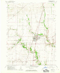
1966 Map of Chrisman
USGS Topo · Published 1967About this map
The railroad junction at Chrisman serves as the focal point for this mid-1960s agricultural landscape in eastern Illinois. Two major rail lines, the Baltimore and Ohio and the New York Central, intersect within the town, illustrating the area's importance as a shipping hub for the surrounding Edgar County prairies. Outside the main settlement, the land is dotted with small rural communities like Bloomfield, Edgar, and Mortimer, many of which are anchored by family burial grounds such as Gaines Cem and Ross Cem.
Find a feature on this map
28 named features on this map. Tap any name to fly to it.
Don’t see what you’re looking for? This feature index may not catch every label — zoom into the map to look around manually.
Map Details
Editions of this 1966 Chrisman Map
This is the sole edition of this map. No revisions or reprints were ever made.
Other maps of this area

1946 · Kansas
USGS Topo · 1:62,500

1947 · Ridge Farm
USGS Topo · 1:62,500

1947 · Paris
USGS Topo · 1:62,500

1949 · Kansas
USGS Topo · 1:62,500

1949 · Paris
USGS Topo · 1:62,500

1951 · Saint Bernice
USGS Topo · 1:24,000

1953 · Indianapolis
USGS Topo · 1:250,000

1955 · Humrick
USGS Topo · 1:24,000

1955 · Scottland
USGS Topo · 1:24,000

1956 · Indianapolis
USGS Topo · 1:250,000