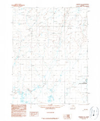
1990 Map of Christian A-4
USGS Topo · Published 1990About this map
Yukon Flats National Wildlife Refuge encompasses a significant portion of this interior landscape, which was mapped by the U.S. Geological Survey using aerial photography from 1978 and 1985. The terrain is defined by its complex drainage systems, most notably the winding path of Marten Creek which traverses the central and southern reaches. This 1990 provisional edition documents the land's character before more recent environmental shifts, preserving the layout of seasonal routes like the Winter Trail in the northwest. The presence of these specific water and transit markers offers a record of the region's accessibility and environmental management during the late twentieth century, particularly within the boundaries of the established wildlife refuge.
Find a feature on this map
3 named features on this map. Tap any name to fly to it.
Don’t see what you’re looking for? This feature index may not catch every label — zoom into the map to look around manually.
Map Details
Editions of this 1990 Christian A-4 Map
This is the sole edition of this map. No revisions or reprints were ever made.
Other maps of this area

1951 · Fort Yukon
USGS Topo · 1:250,000

1951 · Christian
USGS Topo · 1:250,000

1955 · Fort Yukon D-3
USGS Topo · 1:63,360

1955 · Fort Yukon D-4
USGS Topo · 1:63,360

1955 · Fort Yukon D-5
USGS Topo · 1:63,360

1956 · Christian
USGS Topo · 1:250,000

1956 · Fort Yukon
USGS Topo · 1:250,000
1956 · Fort Yukon D-3
USGS Topo · 1:63,360
1956 · Fort Yukon D-4
USGS Topo · 1:63,360
1956 · Fort Yukon D-5
USGS Topo · 1:63,360