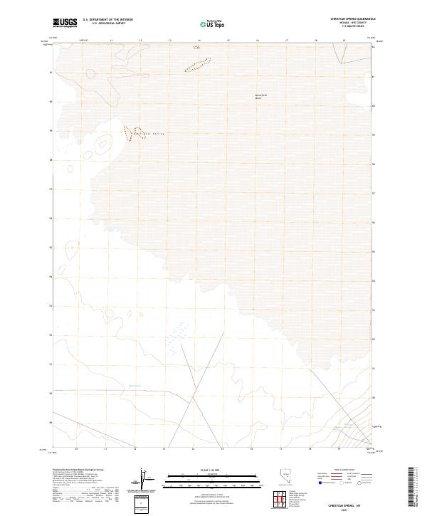
2021 Map of Christian Spring
USGS Topo · Published 2021About this map
Railroad Valley dominates this high-desert landscape in Nye County, showing a geography defined by its hydrological features. In an area where water is the primary driver of site-specific naming and human activity, several critical water sources are documented, including Christian Spring, Brick Kiln Spring, and Briar Spring. These points likely served as essential landmarks for movement across the arid basin. To the north, the terrain transitions into the low-lying expanse of Butterfield Marsh, highlighting the varied wetland characteristics of this enclosed drainage basin. The survey clearly delineates the township and range lines, such as t7n r56e, providing a precise grid for local history researchers and land use analysis in this part of the Nevada desert.
Find a feature on this map
9 named features on this map. Tap any name to fly to it.
Don’t see what you’re looking for? This feature index may not catch every label — zoom into the map to look around manually.
Map Details
Editions of this 2021 Christian Spring Map
This is the sole edition of this map. No revisions or reprints were ever made.
Other maps of this area

1956 · Lund
USGS Topo · 1:250,000

1960 · Lund
USGS Topo · 1:250,000

1964 · Blue Eagle Springs
USGS Topo · 1:62,500

1964 · Troy Canyon
USGS Topo · 1:62,500

1968 · Portuguese Mtn
USGS Topo · 1:62,500

1968 · The Wall
USGS Topo · 1:62,500
1968 · The Wall SE
USGS Topo · 1:24,000
1968 · Lockes
USGS Topo · 1:24,000
1968 · The Wall NE
USGS Topo · 1:24,000

1980 · Duckwater
USGS Topo · 1:100,000