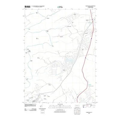
2010 Map of Christmans
USGS Topo · Published 2010About this map
The Lehigh River snakes through the western edge of this Carbon County landscape, carving through prominent terrain like Bald Mountain and Scrub Mountain. Near the river's bend, the Rockport Tunnel and Penn Haven Junction mark critical infrastructure points in the local transit corridor. The map transitions from the steep valleys of Butcher Hollow to the upland settlements of Christmansville and Unionville, which are centered around a network of rural roads such as School House Rd and Drakes Creek Rd.
Find a feature on this map
70 named features on this map. Tap any name to fly to it.
Don’t see what you’re looking for? This feature index may not catch every label — zoom into the map to look around manually.
Map Details
Editions of this 2010 Christmans Map
This is the sole edition of this map. No revisions or reprints were ever made.
Other maps of this area

1889 · Hazleton
USGS Topo · 1:62,500

1891 · Wilkesbarre
USGS Topo · 1:62,500

1891 · Hazleton
USGS Topo · 1:62,500

1893 · Hazleton
USGS Topo · 1:62,500

1894 · Wilkesbarre
USGS Topo · 1:62,500

1922 · Mauch Chunk
USGS Topo · 1:62,500

1922 · Stoddartsville
USGS Topo · 1:62,500

1924 · Stoddartsville
USGS Topo · 1:62,500

1924 · Mauch Chunk
USGS Topo · 1:62,500

1943 · Scranton
USGS Topo · 1:125,000
Featured Places
- Jim Thorpe, PA
- Kidder Township, PA
- CP Independence, Lehigh Township
- Drakes Creek, Penn Forest Township
- Christmans, Penn Forest Township