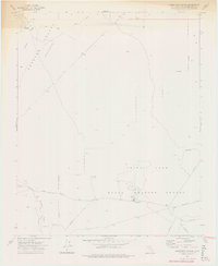
1973 Map of Christmas Canyon
USGS Topo · Published 1975About this map
The Searles Valley (Depression) defines this stretch of the California desert during the early 1970s, dominated by the administrative and operational footprint of the Naval Weapons Center. The map documents a landscape of strategic isolation, where Randsburg Wash Headquarters sits amidst a network of restricted access routes and monitoring stations, including several Radio Tower sites.
Find a feature on this map
14 named features on this map. Tap any name to fly to it.
Don’t see what you’re looking for? This feature index may not catch every label — zoom into the map to look around manually.
Map Details
Editions of this 1973 Christmas Canyon Map
3 editions found
Other maps of this area

1915 · Searles Lake
USGS Topo · 1:250,000

1947 · Trona
USGS Topo · 1:250,000

1948 · Trona
USGS Topo · 1:250,000

1949 · Searles Lake
USGS Topo · 1:62,500

1950 · Searles Lake
USGS Topo · 1:62,500

1950 · Wingate Pass
USGS Topo · 1:62,500

1951 · Wingate Pass
USGS Topo · 1:62,500

1953 · Trona
USGS Topo · 1:250,000

1954 · Pilot Knob
USGS Topo · 1:62,500

1954 · Cuddeback Lake
USGS Topo · 1:62,500