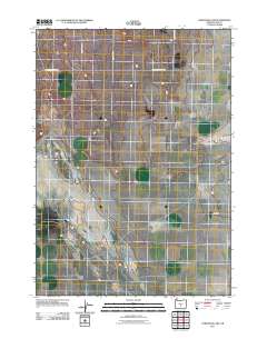
2011 Map of Christmas Lake
USGS Topo · Published 2011About this map
Lake County's high desert landscape is defined by its expansive, level terrain and a sparse network of section-line roads. This 2011 survey focuses on the arid basins near the Fossil Lake area, where the vast, sandy plains and dry lakebeds dominate the environment. The road system is composed primarily of unpaved routes like Bunchgrass Butte Rd and Fossil Lake Rd, which provide access to this remote interior of Oregon. The grid-like arrangement of County Hwy 5-14 and County Rd 5-14 indicates the historical legacy of the Public Land Survey System, though the region remains largely uninhabited and used primarily for resource management or scientific study of its ancient lake beds.
Find a feature on this map
6 named features on this map. Tap any name to fly to it.
Don’t see what you’re looking for? This feature index may not catch every label — zoom into the map to look around manually.
Map Details
Editions of this 2011 Christmas Lake Map
This is the sole edition of this map. No revisions or reprints were ever made.
Other maps of this area

1955 · Crescent
USGS Topo · 1:250,000

1957 · Crescent
USGS Topo · 1:250,000

1958 · Crescent
USGS Topo · 1:250,000

1970 · Crescent
USGS Topo · 1:250,000

1981 · Fossil Lake
USGS Topo · 1:24,000

1981 · Mean Rock Well
USGS Topo · 1:24,000

1982 · Peters Creek Sink
USGS Topo · 1:24,000

1982 · Christmas Lake
USGS Topo · 1:24,000

1982 · Jacks Place
USGS Topo · 1:24,000
1983 · Crack-in-the-Ground
USGS Topo · 1:24,000