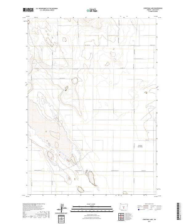
2023 Map of Christmas Lake
USGS Topo · Published 2023About this map
The high desert landscape of Lake County is defined here by the presence of Christmas Lake Valley and the seasonal basin of Christmas Lake. This 2023 survey by the U.S. Geological Survey shows a network of remote access roads that follow the rectangular grid of the Public Land Survey System, carving through the arid terrain of T25S, T26S, and T27S. Named thoroughfares like Stonehouse Rd, Rock House Rd, and Fossil Lake Rd point to the area's geological and pioneer heritage, while Lost Forest Ln indicates the unique localized ecosystems found within the wider sagebrush steppe. The settlement pattern is sparse, concentrated near the intersection of Co Hwy 5-14D and various local connectors, providing a clear view of modern land management and irrigation footprints in a traditionally dry environment.
Find a feature on this map
26 named features on this map. Tap any name to fly to it.
Don’t see what you’re looking for? This feature index may not catch every label — zoom into the map to look around manually.
Map Details
Editions of this 2023 Christmas Lake Map
This is the sole edition of this map. No revisions or reprints were ever made.
Other maps of this area

1955 · Crescent
USGS Topo · 1:250,000

1957 · Crescent
USGS Topo · 1:250,000

1958 · Crescent
USGS Topo · 1:250,000

1970 · Crescent
USGS Topo · 1:250,000

1981 · Fossil Lake
USGS Topo · 1:24,000

1981 · Mean Rock Well
USGS Topo · 1:24,000

1982 · Peters Creek Sink
USGS Topo · 1:24,000

1982 · Christmas Lake
USGS Topo · 1:24,000

1982 · Jacks Place
USGS Topo · 1:24,000
1983 · Crack-in-the-Ground
USGS Topo · 1:24,000