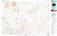
1986 Map of Christmas Valley
USGS Topo · Published 1994About this map
Christmas Valley occupies the center of this high desert landscape, characterized by an extensive network of volcanic and lacustrine features in central Oregon. The map reveals a land shaped by ancient geothermal activity, prominently featuring the East Lava Field and the curious geological fissure known as Crack in the Ground. To the north, the Lost Forest Research Natural Area stands as an isolated woodland remnant amidst the shifting Sand Dunes and the broad expanse of Buffalo Flat.
Find a feature on this map
87 named features on this map. Tap any name to fly to it.
Don’t see what you’re looking for? This feature index may not catch every label — zoom into the map to look around manually.
Map Details
Editions of this 1986 Christmas Valley Map
2 editions found
Other maps of this area

1889 · Klamath
USGS Topo · 1:250,000

1894 · Klamath
USGS Topo · 1:250,000

1931 · Newberry Crater
USGS Topo · 1:125,000

1935 · Newberry Crater
USGS Topo · 1:125,000

1955 · Crescent
USGS Topo · 1:250,000

1955 · Klamath Falls
USGS Topo · 1:250,000

1955 · Burns
USGS Topo · 1:250,000

1955 · Adel
USGS Topo · 1:250,000

1957 · Adel
USGS Topo · 1:250,000

1957 · Crescent
USGS Topo · 1:250,000