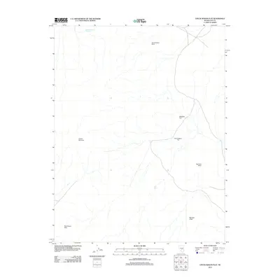
2012 Map of Chuck Wagon Flat
USGS Topo · Published 2012About this map
Citadel Mountain dominates the western portion of this Nye County landscape, overlooking an arid expanse defined by significant geologic formations and sparse water resources. The terrain is marked by a series of flats and elevated plateaus, most notably Chuck Wagon Flat and Mesquite Flat, which suggest a topography utilized for ranching or seasonal grazing. Water management in this high desert environment is evidenced by Badland Reservoir Number Two in the north and the isolated Tule Spring to the south. The eastern edge of the quadrangle is defined by prominent escarpments, including Big Fault Mesa and Big Fault Ridge, which reveal the tectonic activity characterizing this section of Nevada. These features, along with Black Beauty Mesa, provide a detailed record of the natural landforms that dictate movement and land use in this sparsely settled region.
Find a feature on this map
9 named features on this map. Tap any name to fly to it.
Don’t see what you’re looking for? This feature index may not catch every label — zoom into the map to look around manually.
Map Details
Editions of this 2012 Chuck Wagon Flat Map
This is the sole edition of this map. No revisions or reprints were ever made.
Other maps of this area

1956 · Lund
USGS Topo · 1:250,000

1956 · Tonopah
USGS Topo · 1:250,000

1959 · Tonopah
USGS Topo · 1:250,000

1960 · Lund
USGS Topo · 1:250,000

1962 · Tonopah
USGS Topo · 1:250,000

1967 · Lunar Crater
USGS Topo · 1:62,500

1967 · Buckwheat Rim
USGS Topo · 1:24,000

1967 · Palisade Mesa
USGS Topo · 1:24,000

1967 · Lunar Crater
USGS Topo · 1:24,000
1967 · Chuck Wagon Flat
USGS Topo · 1:24,000