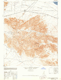
1944 Map of Chuckwalla Mountains
USGS Topo · Published 1952About this map
Desert Center stands as a critical outpost along the highway at the edge of the Chuckwalla Valley during the mid-1940s. This survey, compiled by the Army Map Service using 1940 aerial photography, reveals a landscape defined by isolated water sources and remote mining claims. To the south, the massive uplift of the Chuckwalla Mountains is dotted with legacy extraction sites like the Red Cloud Mine and the Lost Pony Mine, connected by winding desert trails. The presence of Guilliday Well (Dry) and Aztec Well illustrates the precarious nature of water in this arid environment, while Corn Springs remains a vital oasis. The map also delineates a military reservation boundary, reflecting the region's importance as a training ground during the war years, with landmarks like Black Butte and Pilot Mountain serving as dominant navigational aids across the desert floor.
Find a feature on this map
23 named features on this map. Tap any name to fly to it.
Don’t see what you’re looking for? This feature index may not catch every label — zoom into the map to look around manually.
Map Details
Editions of this 1944 Chuckwalla Mountains Map
3 editions found
Other maps of this area

1940 · Frink
USGS Topo · 1:62,500

1940 · Iris Pass
USGS Topo · 1:62,500

1940 · Canyon Spring
USGS Topo · 1:62,500

1943 · Canyon Spring
USGS Topo · 1:62,500

1943 · Coxcomb Mountains
USGS Topo · 1:62,500

1944 · Eagle Tank
USGS Topo · 1:62,500

1944 · Chuckwalla Mountains
USGS Topo · 1:62,500

1944 · Coxcomb Mountains
USGS Topo · 1:62,500

1944 · Frink
USGS Topo · 1:62,500

1945 · Iris Pass
USGS Topo · 1:62,500