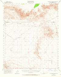
1953 Map of Chuckwalla Spring
USGS Topo · Published 1968About this map
Chuckwalla Mountains and the Little Chuckwalla Mountains dominate this 1950s desert landscape, a region defined by critical water sources and rugged transit corridors. The historic Butterfield Stage Route traverses the center of the sheet, providing a tangible link to 19th-century overland travel before it is superseded by the Niland-Blythe Road. Life in this arid environment centers on essential stops like Chuckwalla Spring, Indian Well, and Pegleg Well.
Find a feature on this map
32 named features on this map. Tap any name to fly to it.
Don’t see what you’re looking for? This feature index may not catch every label — zoom into the map to look around manually.
Map Details
Editions of this 1953 Chuckwalla Spring Map
3 editions found

Other maps of this area

1940 · Iris
USGS Topo · 1:62,500

1940 · Iris Pass
USGS Topo · 1:62,500

1942 · Blythe
USGS Topo · 1:250,000

1944 · Chuckwalla Mountains
USGS Topo · 1:62,500

1945 · Iris Pass
USGS Topo · 1:62,500

1945 · Iris
USGS Topo · 1:62,500

1952 · Mc Coy Spring
USGS Topo · 1:62,500

1952 · Sidewinder Well
USGS Topo · 1:62,500

1953 · Palo Verde Mountains
USGS Topo · 1:62,500

1953 · Quartz Peak
USGS Topo · 1:62,500