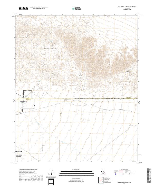
2021 Map of Chuckwalla Spring
USGS Topo · Published 2021About this map
The Chuckwalla Mountains dominate this arid landscape where the boundary between Riverside and Imperial counties cuts through the Colorado Desert. The presence of water sources like Chuckwalla Spring and Mesquite Spring dictated the path of historical movement across this terrain, supporting travel long before modern road networks. Historical routes are clearly visible, including The Bradshaw Trl and Butterfield Trl, which follow the contours of the desert floor and mountain passes. To the southeast, the Little Chuckwalla Mountains rise near Graham Pass, while the southern portion of the sheet is marked by the expansive Choc Mt Air Gnry Rng and the drainage of the Arroyo Seco. The map illustrates a crossroads of desert history where ancient paths meet modern military and county divisions.
Find a feature on this map
17 named features on this map. Tap any name to fly to it.
Don’t see what you’re looking for? This feature index may not catch every label — zoom into the map to look around manually.
Map Details
Editions of this 2021 Chuckwalla Spring Map
This is the sole edition of this map. No revisions or reprints were ever made.
Other maps of this area

1940 · Iris Pass
USGS Topo · 1:62,500

1944 · Chuckwalla Mountains
USGS Topo · 1:62,500

1945 · Iris Pass
USGS Topo · 1:62,500

1952 · Sidewinder Well
USGS Topo · 1:62,500

1953 · Chuckwalla Spring
USGS Topo · 1:62,500

1954 · Salton Sea
USGS Topo · 1:250,000

1955 · Salton Sea
USGS Topo · 1:250,000

1959 · Salton Sea
USGS Topo · 1:250,000

1963 · Salton Sea
USGS Topo · 1:250,000
1963 · Iris Pass
USGS Topo · 1:62,500