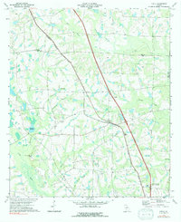
1973 Map of Chula
USGS Topo · Published 1991About this map
The Georgia Southern and Florida railroad corridor anchors this agricultural landscape, running through the rural settlements of Inaha, Sunsweet, and Chula. In the early 1970s, this area of South Georgia maintained a traditional distribution of small country congregations and rural schools, including Mt Zion Ch, Friendship Ch, and Mt Olive Ch, alongside the Tift Sch.
Find a feature on this map
27 named features on this map. Tap any name to fly to it.
Don’t see what you’re looking for? This feature index may not catch every label — zoom into the map to look around manually.
Map Details
Editions of this 1973 Chula Map
2 editions found
Other maps of this area

1953 · Waycross
USGS Topo · 1:250,000

1958 · Waycross
USGS Topo · 1:250,000

1973 · Sumner
USGS Topo · 1:24,000

1973 · Ty Ty
USGS Topo · 1:24,000

1973 · Waterloo
USGS Topo · 1:24,000

1973 · Irwinville
USGS Topo · 1:24,000

1973 · Ashburn
USGS Topo · 1:24,000

1973 · Chula
USGS Topo · 1:24,000

1973 · Tifton East
USGS Topo · 1:24,000

1973 · Tifton West
USGS Topo · 1:24,000