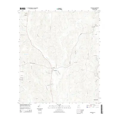
2014 Map of Chunchula
USGS Topo · Published 2014About this map
Chunchula stands as a central settlement in this northern Mobile County landscape, where the corridor of Us-45 cuts through a dense network of creek drainages and timbered tracts. The terrain is defined by the winding course of Chickasaw Cr and its many tributaries, including Sweetwater Br and Beaver Pond Cr, which have shaped the local topography and placement of early homesteads. To the north, the community of Gulfcrest is marked by the Gulf Crest Cem, while to the east, Turnerville sits near Duboise Lake and the Turnerville Cem. The map reveals a transition toward the suburban edge of Saraland in the southeast corner. Numerous family-named roads like Walter Moore Rd, Sealeys Ln, and Rudolph Gallasch Rd reflect the deep-rooted local history and parcel divisions of the early 21st century.
Find a feature on this map
60 named features on this map. Tap any name to fly to it.
Don’t see what you’re looking for? This feature index may not catch every label — zoom into the map to look around manually.
Map Details
Editions of this 2014 Chunchula Map
This is the sole edition of this map. No revisions or reprints were ever made.
Other maps of this area

1941 · Chickasaw
USGS Topo · 1:31,680

1941 · Creola
USGS Topo · 1:62,500

1942 · Kushla
USGS Topo · 1:31,680

1942 · Deer Park
USGS Topo · 1:62,500

1942 · Wilmer
USGS Topo · 1:62,500

1943 · Creola
USGS Topo · 1:62,500

1943 · Chickasaw
USGS Topo · 1:31,680

1943 · Deer Park
USGS Topo · 1:62,500

1943 · Citronelle
USGS Topo · 1:62,500

1944 · Wilmer
USGS Topo · 1:62,500