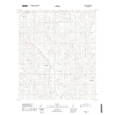
2020 Map of Chunchula
USGS Topo · Published 2020About this map
Chunchula and Gulfcrest anchor this portion of Mobile County, where the coastal plain is dissected by a dense network of creek systems flowing toward the Gulf. The landscape is defined by the headwaters and branches of Chickasaw Cr and Bayou Sara, with significant watercourses like Silver Cr and Beaver Pond Cr carving through the terrain. Evidence of the area's local history and community structure is found in the placement of the Gulfcrest Cem and Turnerville Cem, alongside longstanding transportation routes such as the Old Citronelle Hwy and Chunchula Georgetown Rd. While the southeastern corner touches the edge of Saraland, the map primarily illustrates a rural and residential pattern of development structured around family-named roads like Pesleys Ponderosa and Rudolph Gallasch Rd. Local landmarks like Duboise Lake provide insight into the drainage and water management of this humid Alabama corridor.
Find a feature on this map
69 named features on this map. Tap any name to fly to it.
Don’t see what you’re looking for? This feature index may not catch every label — zoom into the map to look around manually.
Map Details
Editions of this 2020 Chunchula Map
This is the sole edition of this map. No revisions or reprints were ever made.
Other maps of this area

1941 · Chickasaw
USGS Topo · 1:31,680

1941 · Creola
USGS Topo · 1:62,500

1942 · Kushla
USGS Topo · 1:31,680

1942 · Deer Park
USGS Topo · 1:62,500

1942 · Wilmer
USGS Topo · 1:62,500

1943 · Creola
USGS Topo · 1:62,500

1943 · Chickasaw
USGS Topo · 1:31,680

1943 · Deer Park
USGS Topo · 1:62,500

1943 · Citronelle
USGS Topo · 1:62,500

1944 · Wilmer
USGS Topo · 1:62,500