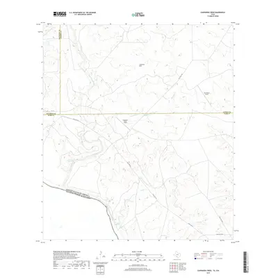
2019 Map of Chupadera Creek
USGS Topo · Published 2019About this map
The Rio Grande forms a prominent international boundary along the southwestern corner of this South Texas landscape, where the United States of America meets Mexico. This area is characterized by a network of seasonal drainages and watering points essential for ranching, including the San Ambrosia Creek, Chupadera Creek, and Jardin Creek. Topographic landmarks such as Cathedral Rock rise above the surrounding terrain, while isolated water sources like Chupadera Spring, Sullivan Spring, and Loza Tank highlight the importance of hydrology in this arid region. The map reveals a land utilized for large-scale operations, evidenced by the Faith Ranch Airport and Chupadera Ranch Airport, both situated along private ranch roads. Modern infrastructure is represented by FM 1021 and the winding Eagle Pass Road, providing the primary transit routes through this borderland territory.
Find a feature on this map
20 named features on this map. Tap any name to fly to it.
Don’t see what you’re looking for? This feature index may not catch every label — zoom into the map to look around manually.
Map Details
Editions of this 2019 Chupadera Creek Map
This is the sole edition of this map. No revisions or reprints were ever made.
Other maps of this area

1929 · Cotulla
USGS Topo · 1:125,000

1940 · Asherton
USGS Topo · 1:62,500

1940 · San Loranzo Creek
USGS Topo · 1:62,500

1940 · Chupadera
USGS Topo · 1:62,500

1941 · Botella Creek
USGS Topo · 1:62,500

1953 · Crystal City
USGS Topo · 1:250,000

1955 · Crystal City
USGS Topo · 1:250,000

1957 · Botella Creek
USGS Topo · 1:62,500

1958 · Eagle Pass
USGS Topo · 1:250,000

1961 · Crystal City
USGS Topo · 1:250,000