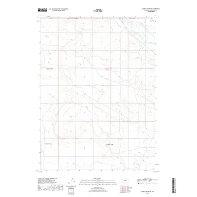
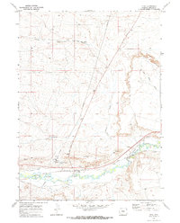
2017 Map of Church Butte NW
USGS Topo · Published 2017About this map
Hams Fork meanders through the northeast corner of this high-plains landscape, where historic irrigation efforts are etched into the terrain. The map traces the paths of the Old Mexican Ditch and the lengthy Winslow Hallock and Capen Ditch, reflecting the vital role of water management in Lincoln County's development. These man-made channels contrast with the natural drainage of Zieglers Wash, which cuts across the central and southern sections of the quadrangle. Dominating the northern horizon, the prominent landform of Chrisman Bench provides a clear landmark for researchers studying the geographic layout of these rural townships. The absence of modern urban development highlights the area's continued use as open range and agricultural land, where the grid of the Public Land Survey System defines the ownership and movement across the territory.
Find a feature on this map
11 named features on this map. Tap any name to fly to it.
Don’t see what you’re looking for? This feature index may not catch every label — zoom into the map to look around manually.
Map Details
Editions of this 2017 Church Butte NW Map
This is the sole edition of this map. No revisions or reprints were ever made.
Other maps of this area

1954 · Ogden
USGS Topo · 1:250,000

1958 · Ogden
USGS Topo · 1:250,000

1960 · Ogden
USGS Topo · 1:250,000

1969 · Church Butte NW
USGS Topo · 1:24,000
1969 · Moxa
USGS Topo · 1:24,000
1969 · Verne
USGS Topo · 1:24,000

1969 · Roberson Creek
USGS Topo · 1:24,000

1969 · Hampton
USGS Topo · 1:24,000
1969 · Church Butte
USGS Topo · 1:24,000
1969 · Opal
USGS Topo · 1:24,000