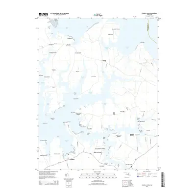
2014 Map of Church Creek
USGS Topo · Published 2014About this map
Church Creek and the intricate peninsulas of the lower Eastern Shore are documented here in detail, revealing a landscape defined by tidewater proximity and a long history of maritime settlement. The map traces the winding shoreline from Madison Bay and Hudson Creek to the various points and necks extending into Lecompte Bay. Local heritage is anchored by several historic burial grounds, including Saint Johns Chapel Cem and Trinity Cem, which serve as vital landmarks for genealogists tracing family roots in this corner of Dorchester County. Small residential clusters like Dailsville, Cornersville, and Woolford are linked by rural corridors such as MD-16, while private airstrips like Pokety Airport and Horn Point Airport suggest the modern usage of these expansive coastal properties. The arrangement of Town Point Estates and Snug Harbor Estates indicates contemporary waterfront development alongside older, established communities.
Find a feature on this map
81 named features on this map. Tap any name to fly to it.
Don’t see what you’re looking for? This feature index may not catch every label — zoom into the map to look around manually.
Map Details
Editions of this 2014 Church Creek Map
This is the sole edition of this map. No revisions or reprints were ever made.
Other maps of this area

1892 · Drum Point
USGS Topo · 1:62,500

1893 · Sharps Island
USGS Topo · 1:62,500

1898 · Choptank
USGS Topo · 1:125,000

1898 · St. Marys
USGS Topo · 1:125,000

1901 · Drum Point
USGS Topo · 1:62,500

1904 · Sharps Island
USGS Topo · 1:62,500

1904 · Oxford
USGS Topo · 1:62,500

1905 · Crapo
USGS Topo · 1:62,500

1905 · Drum Point
USGS Topo · 1:62,500

1906 · St. Marys
USGS Topo · 1:125,000