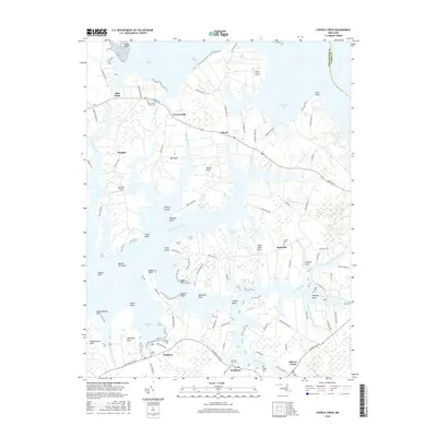
2016 Map of Church Creek
USGS Topo · Published 2016About this map
Church Creek and its neighboring Eastern Shore settlements sit amidst a deeply fragmented landscape of tidal inlets and low-lying points defined by the Little Choptank River. This area is characterized by centuries of maritime-oriented land use, where small communities like Madison and Woolford are linked by winding roads that skirt the marshy edges of Madison Bay and Woolford Creek. For genealogists and local historians, the sheet is particularly valuable for its precise documentation of scattered burial grounds, including Saint Johns Chapel Cem and Trinity Cem. The terrain is almost entirely shaped by water, with dozens of named landforms such as Town Point Neck and Hills Point punctuating the shoreline. Beyond the village centers, aviation history is noted by the presence of Pokety Airport and Rossneck Airport, reflecting the region's private flying heritage.
Find a feature on this map
106 named features on this map. Tap any name to fly to it.
Don’t see what you’re looking for? This feature index may not catch every label — zoom into the map to look around manually.
Map Details
Editions of this 2016 Church Creek Map
This is the sole edition of this map. No revisions or reprints were ever made.
Other maps of this area

1892 · Drum Point
USGS Topo · 1:62,500

1893 · Sharps Island
USGS Topo · 1:62,500

1898 · Choptank
USGS Topo · 1:125,000

1898 · St. Marys
USGS Topo · 1:125,000

1901 · Drum Point
USGS Topo · 1:62,500

1904 · Sharps Island
USGS Topo · 1:62,500

1904 · Oxford
USGS Topo · 1:62,500

1905 · Crapo
USGS Topo · 1:62,500

1905 · Drum Point
USGS Topo · 1:62,500

1906 · St. Marys
USGS Topo · 1:125,000