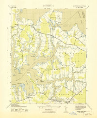
1943 Map of Church Creek
USGS Topo · Published 1943About this map
Hudson Neck and its surrounding marshy peninsulas define this mid-war study of the Maryland shoreline. The landscape is characterized by its heavy reliance on water access, visible through numerous small harbors like Solomons Cove and Madison Bay. Small, established communities such as Madison, Woolford, and Church Creek are connected by a network of local roads including McKeil Point Road and Bar Neck Road. Local faith and community life are well-documented by several landmarks including Gethsemane Church and the Woolford Mace Cemetery.
Find a feature on this map
70 named features on this map. Tap any name to fly to it.
Don’t see what you’re looking for? This feature index may not catch every label — zoom into the map to look around manually.
Map Details
Editions of this 1943 Church Creek Map
This is the sole edition of this map. No revisions or reprints were ever made.
Other maps of this area

1892 · Drum Point
USGS Topo · 1:62,500

1893 · Sharps Island
USGS Topo · 1:62,500

1898 · Choptank
USGS Topo · 1:125,000

1898 · St. Marys
USGS Topo · 1:125,000

1901 · Drum Point
USGS Topo · 1:62,500

1904 · Sharps Island
USGS Topo · 1:62,500

1904 · Oxford
USGS Topo · 1:62,500

1905 · Crapo
USGS Topo · 1:62,500

1905 · Drum Point
USGS Topo · 1:62,500

1906 · St. Marys
USGS Topo · 1:125,000