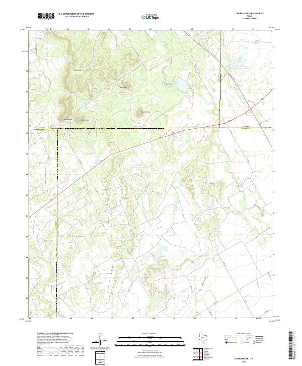
2022 Map of Church Peak
USGS Topo · Published 2022About this map
Church Peak and the surrounding high ground of the Callahan Divide define this West Texas landscape where four counties — Nolan, Taylor, Coke, and Runnels — converge. The terrain is characterized by a series of prominent mesas and summits including Hylton Mtn, Mathis Mtn, and Jackson Mtn, which frame the local passage known as Cedar Gap. This high-country drainage network feeds several small watercourses like Wagon-Tire Cr and Fish Cr, punctuated by mid-century water management projects.
Find a feature on this map
37 named features on this map. Tap any name to fly to it.
Don’t see what you’re looking for? This feature index may not catch every label — zoom into the map to look around manually.
Map Details
Editions of this 2022 Church Peak Map
This is the sole edition of this map. No revisions or reprints were ever made.
Other maps of this area

1891 · Hayrick
USGS Topo · 1:125,000

1893 · Sweetwater
USGS Topo · 1:125,000

1894 · Hayrick
USGS Topo · 1:125,000

1921 · Bronte
USGS Topo · 1:31,680

1954 · Big Spring
USGS Topo · 1:250,000

1954 · San Angelo
USGS Topo · 1:250,000

1958 · San Angelo
USGS Topo · 1:250,000

1958 · Big Spring
USGS Topo · 1:250,000
1961 · Hog Mountain
USGS Topo · 1:24,000
1961 · Bronte
USGS Topo · 1:24,000