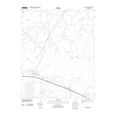
2010 Map of Church Rock
USGS Topo · Published 2010About this map
Red Rocks and the distinctive formations of Pyramid Rock define this high-desert landscape in the early 21st century. The map centers on the community of Church Rock, anchored by the Church Rock Post Office and a history of local industry visible through numerous uranium extraction sites. These include the Church Rock Mine, Williams and Reynolds Mine, and the multi-part Foutz Number 1 Mine operations.
Find a feature on this map
44 named features on this map. Tap any name to fly to it.
Don’t see what you’re looking for? This feature index may not catch every label — zoom into the map to look around manually.
Map Details
Editions of this 2010 Church Rock Map
This is the sole edition of this map. No revisions or reprints were ever made.
Other maps of this area

1886 · Wingate
USGS Topo · 1:250,000

1892 · Wingate
USGS Topo · 1:250,000

1954 · Gallup
USGS Topo · 1:250,000

1958 · Gallup
USGS Topo · 1:250,000

1959 · Gallup
USGS Topo · 1:250,000

1962 · Gallup
USGS Topo · 1:250,000

1962 · Ciniza
USGS Topo · 1:24,000

1963 · Big Rock Hill
USGS Topo · 1:24,000
1963 · Pinedale
USGS Topo · 1:24,000
1963 · Church Rock
USGS Topo · 1:24,000
Featured Places
- Gallup, NM
- Eastern Navajo Agency, NM
- Navajo Wingate Village, Eastern Navajo Agency
- Wingate, Eastern Navajo Agency
- Church Rock, Eastern Navajo Agency