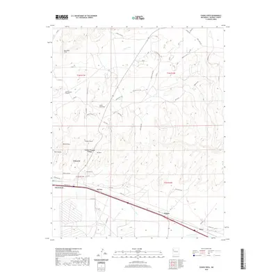
2020 Map of Church Rock
USGS Topo · Published 2020About this map
Navajo Wingate Village and the eastern outskirts of Gallup define this high-desert landscape in McKinley County. The terrain is marked by significant geological formations, most notably the towering spires of Navajo Church and the prominent Pyramid Rock standing above Padre Canyon. Historical water sources like Kit Carson Spring are nestled near the Red Rocks, indicating the vital importance of springs in this arid region. The drainage of the Puerco River and its South Fork dictate the modern transportation corridor, where the railroad and highway pass through settlements like McCune, Wingate, and Perea. To the north, the landscape opens into broad features such as White Rock Mesa and Nose Rock Point, crisscrossed by a network of local routes including the Wagon Trail Rd and various Indian Service Routes, reflecting the ongoing connection between these communities and the surrounding mesas.
Find a feature on this map
63 named features on this map. Tap any name to fly to it.
Don’t see what you’re looking for? This feature index may not catch every label — zoom into the map to look around manually.
Map Details
Editions of this 2020 Church Rock Map
This is the sole edition of this map. No revisions or reprints were ever made.
Other maps of this area

1886 · Wingate
USGS Topo · 1:250,000

1892 · Wingate
USGS Topo · 1:250,000

1954 · Gallup
USGS Topo · 1:250,000

1958 · Gallup
USGS Topo · 1:250,000

1959 · Gallup
USGS Topo · 1:250,000

1962 · Gallup
USGS Topo · 1:250,000

1962 · Ciniza
USGS Topo · 1:24,000

1963 · Big Rock Hill
USGS Topo · 1:24,000
1963 · Pinedale
USGS Topo · 1:24,000
1963 · Church Rock
USGS Topo · 1:24,000
Featured Places
- Gallup, NM
- Eastern Navajo Agency, NM
- Navajo Wingate Village, Eastern Navajo Agency
- Wingate, Eastern Navajo Agency
- Church Rock, Eastern Navajo Agency