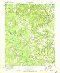
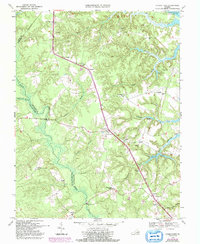
1968 Map of Church View
USGS Topo · Published 1972About this map
Dragon Swamp and its tangled tributaries define the low-lying landscape of the Middle Peninsula during the late 1960s. This survey illustrates a rural Virginia economy centered on scattered settlements and timber, with the sprawling Dragon Swamp acting as a natural boundary between Middlesex and King and Queen counties. The interior is marked by small crossroads such as Church View, Jamaica, and Warner, while larger water features like Masons Mill Pond and Burch Pond indicate the historical importance of milling and water management in the region.
Find a feature on this map
39 named features on this map. Tap any name to fly to it.
Don’t see what you’re looking for? This feature index may not catch every label — zoom into the map to look around manually.
Map Details
Editions of this 1968 Church View Map
5 editions found
Other maps of this area

1917 · Urbanna
USGS Topo · 1:62,500

1917 · Morattico
USGS Topo · 1:62,500

1918 · Tappahannock
USGS Topo · 1:62,500

1918 · Morattico
USGS Topo · 1:62,500

1919 · New Kent
USGS Topo · 1:62,500

1919 · Tappahannock
USGS Topo · 1:62,500

1926 · Morattico
USGS Topo · 1:62,500

1943 · Richmond
USGS Topo · 1:250,000

1944 · Dunnsville
USGS Topo · 1:31,680

1944 · Morattico
USGS Topo · 1:31,680