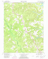
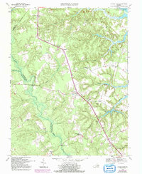
1968 Map of Church View
USGS Topo · Published 1980About this map
Dragon Swamp and a network of named wetlands dominate this Virginia Tidewater landscape, carving through the borders of Middlesex, Essex, and King and Queen Counties. The settlement pattern follows the high ground between these drainages, anchored by crossroads like Church View and Jamaica. The map reflects a rural economy shaped by natural resources and spiritual life, evidenced by numerous sandpits and a high density of country churches, including St Pauls Ch, Metropolitan Ch, and Union Shiloh Ch. To the north, the Rappahannock River shoreline at Globe Landing reveals the area's river-dependent history. This 1968 field-checked record, later updated with 1978 aerial data, captures the transition of small inland communities like Samos and Warner before modern development altered these traditional tobacco and timber-producing reaches of the Middle Peninsula.
Find a feature on this map
41 named features on this map. Tap any name to fly to it.
Don’t see what you’re looking for? This feature index may not catch every label — zoom into the map to look around manually.
Map Details
Editions of this 1968 Church View Map
5 editions found
Other maps of this area

1917 · Urbanna
USGS Topo · 1:62,500

1917 · Morattico
USGS Topo · 1:62,500

1918 · Tappahannock
USGS Topo · 1:62,500

1918 · Morattico
USGS Topo · 1:62,500

1919 · New Kent
USGS Topo · 1:62,500

1919 · Tappahannock
USGS Topo · 1:62,500

1926 · Morattico
USGS Topo · 1:62,500

1943 · Richmond
USGS Topo · 1:250,000

1944 · Dunnsville
USGS Topo · 1:31,680

1944 · Morattico
USGS Topo · 1:31,680