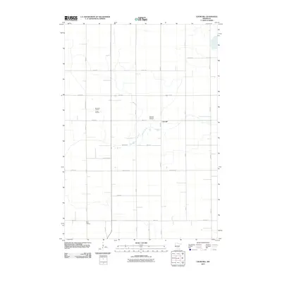
2010 Map of Churchill
USGS Topo · Published 2010About this map
Churchill remains the central point of interest in this agricultural landscape within Renville County. The region is defined by a rigorous grid of section-line roads, such as 850th Ave and County Hwy-11, which partition the fertile plains. For family historians, the area is notably rich in burial sites, featuring the Methodist Episcopal Cemetery near the settlement and several others scattered throughout the rural sections. Buffalo Creek meanders west to east across the center of the sheet, providing the primary natural drainage and a break in the geometric road pattern. The distribution of sites like the Friends Cemetery and Brookfield Cemetery reflects the early denominational settlement patterns of the township. To the south, Saint Pauls Cemetery marks the lower reaches of the survey area, emphasizing the deep communal and historical roots of this farming community.
Find a feature on this map
17 named features on this map. Tap any name to fly to it.
Don’t see what you’re looking for? This feature index may not catch every label — zoom into the map to look around manually.
Map Details
Editions of this 2010 Churchill Map
This is the sole edition of this map. No revisions or reprints were ever made.
Other maps of this area

1952 · Morton
USGS Topo · 1:62,500

1953 · New Ulm
USGS Topo · 1:250,000

1957 · New Ulm
USGS Topo · 1:250,000

1957 · Olivia
USGS Topo · 1:62,500

1958 · New Ulm
USGS Topo · 1:250,000

1964 · Buffalo Lake
USGS Topo · 1:24,000

1964 · Hector
USGS Topo · 1:24,000

1967 · New Ulm
USGS Topo · 1:250,000

1967 · Churchill
USGS Topo · 1:24,000
1967 · Cedar Mills
USGS Topo · 1:24,000