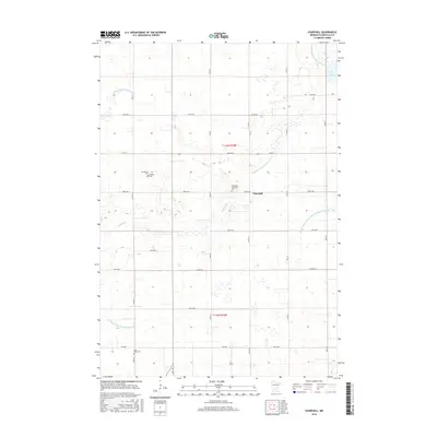
2016 Map of Churchill
USGS Topo · Published 2016About this map
Churchill and its surrounding agricultural landscape appear here as a complex network of managed waterways and rural landmarks. This portion of Renville County is defined by an extensive drainage system, including County Ditch Number Four, Judicial Ditch Number Thirtytwo, and Buffalo Cr. These man-made and natural channels illustrate the significant effort to reclaim and utilize the fertile prairie lands for farming. For genealogists and local historians, several burial grounds are meticulously preserved across the township. The Brookfield Friends Cem, Methodist Episcopal Cem, and Saint Pauls Cem stand as quiet reminders of early settlement patterns and the diverse denominational roots of the community. In the northeast, Boon Lake provides a natural contrast to the grid-like precision of the surrounding county roads and section lines.
Find a feature on this map
36 named features on this map. Tap any name to fly to it.
Don’t see what you’re looking for? This feature index may not catch every label — zoom into the map to look around manually.
Map Details
Editions of this 2016 Churchill Map
This is the sole edition of this map. No revisions or reprints were ever made.
Other maps of this area

1952 · Morton
USGS Topo · 1:62,500

1953 · New Ulm
USGS Topo · 1:250,000

1957 · New Ulm
USGS Topo · 1:250,000

1957 · Olivia
USGS Topo · 1:62,500

1958 · New Ulm
USGS Topo · 1:250,000

1964 · Buffalo Lake
USGS Topo · 1:24,000

1964 · Hector
USGS Topo · 1:24,000

1967 · New Ulm
USGS Topo · 1:250,000

1967 · Churchill
USGS Topo · 1:24,000
1967 · Cedar Mills
USGS Topo · 1:24,000