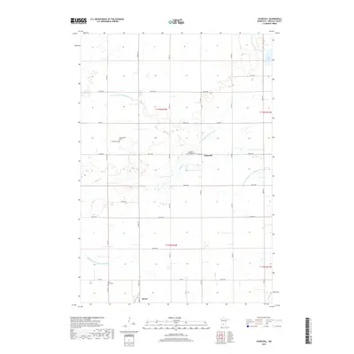
2019 Map of Churchill
USGS Topo · Published 2019About this map
Churchill and the northern outskirts of Hector center this Renville County landscape, where the agricultural geometry of south-central Minnesota is clearly defined by a vast network of water management features. The area is intersected by numerous engineered waterways, including County Ditch Number Seven A and Judicial Ditch Number Thirtytwo, reflecting over a century of land reclamation for farming. These channels coexist with natural features like Buffalo Cr and the waters of Boon Lake in the northeast corner.
Find a feature on this map
32 named features on this map. Tap any name to fly to it.
Don’t see what you’re looking for? This feature index may not catch every label — zoom into the map to look around manually.
Map Details
Editions of this 2019 Churchill Map
This is the sole edition of this map. No revisions or reprints were ever made.
Other maps of this area

1952 · Morton
USGS Topo · 1:62,500

1953 · New Ulm
USGS Topo · 1:250,000

1957 · New Ulm
USGS Topo · 1:250,000

1957 · Olivia
USGS Topo · 1:62,500

1958 · New Ulm
USGS Topo · 1:250,000

1964 · Buffalo Lake
USGS Topo · 1:24,000

1964 · Hector
USGS Topo · 1:24,000

1967 · New Ulm
USGS Topo · 1:250,000

1967 · Churchill
USGS Topo · 1:24,000
1967 · Cedar Mills
USGS Topo · 1:24,000