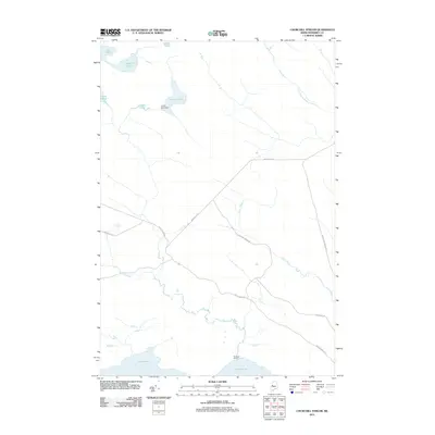
2011 Map of Churchill Stream
USGS Topo · Published 2011About this map
Churchill Camp sits near the southern edge of this Somerset County landscape, a remote interior region defined by its complex network of waterways and timber access roads. The hydrology of the area is centered around several distinct bodies of water including Long Pond, Muskrat Pond, Fish Pond, and Luther Pond, the latter of which features the Luther Pond Dam. These ponds feed a system of drainage including Stony Brook, Barton Brook, and the South Branch Brassua Stream. The infrastructure consists primarily of logging and transport routes such as Brassua 2 Rd and Moose River Rd, which intersect the terrain to provide access to these isolated water resources. The presence of Lost Pond and Mud Pond further illustrates the low-lying, boggy nature of the environment, where narrow corridors like 12 Mile Bog Rd navigate through the Maine wilderness.
Find a feature on this map
16 named features on this map. Tap any name to fly to it.
Don’t see what you’re looking for? This feature index may not catch every label — zoom into the map to look around manually.
Map Details
Editions of this 2011 Churchill Stream Map
This is the sole edition of this map. No revisions or reprints were ever made.
Other maps of this area

1921 · Brassua Lake
USGS Topo · 1:62,500

1922 · Long Pond
USGS Topo · 1:62,500

1923 · Brassua Lake
USGS Topo · 1:62,500

1924 · Long Pond
USGS Topo · 1:62,500

1944 · Brassua Lake
USGS Topo · 1:62,500

1944 · Long Pond
USGS Topo · 1:62,500

1949 · Jackman
USGS Topo · 1:250,000

1954 · Seboomook Lake
USGS Topo · 1:62,500

1954 · Millinocket
USGS Topo · 1:250,000

1956 · Penobscot Lake
USGS Topo · 1:62,500
Featured Places
- Thorndike Township, ME
- Brassua Township, ME
- Rockwood Strip T2 R1 NBKP, ME
- Long Pond Township, ME
- Sandwich Academy Grant Township, ME