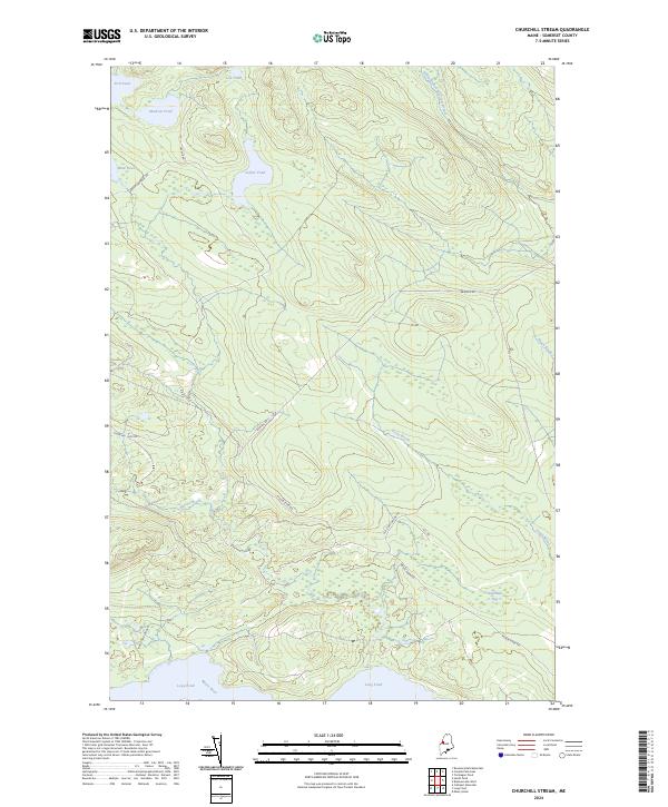
2024 Map of Churchill Stream
USGS Topo · Published 2024About this map
Moose River and the northern shores of Long Pond define this Somerset County landscape, where the interior is shaped by a dense network of timber-access roads and water bodies. The terrain transitions from the high-elevation wetlands of Twelvemile Bog to numerous isolated basins like Luther Pond, Muskrat Pond, and Fish Pond. A sophisticated system of logging and recreational routes, including Brassua Rd and Moose River Rd, crisscrosses the drainages of South Branch Brassua Stream and Stony Brook. This area serves as a primary drainage corridor for the north-central Maine woods, where the lack of permanent residential settlements emphasizes its role as a working forest and ecological preserve. The map captures the current state of these water-rich woods, providing a clear view of the hydrological connections between the many unnamed tributaries and the larger Moose River basin.
Find a feature on this map
23 named features on this map. Tap any name to fly to it.
Don’t see what you’re looking for? This feature index may not catch every label — zoom into the map to look around manually.
Map Details
Editions of this 2024 Churchill Stream Map
This is the sole edition of this map. No revisions or reprints were ever made.
Other maps of this area

1921 · Brassua Lake
USGS Topo · 1:62,500

1922 · Long Pond
USGS Topo · 1:62,500

1923 · Brassua Lake
USGS Topo · 1:62,500

1924 · Long Pond
USGS Topo · 1:62,500

1944 · Brassua Lake
USGS Topo · 1:62,500

1944 · Long Pond
USGS Topo · 1:62,500

1949 · Jackman
USGS Topo · 1:250,000

1954 · Seboomook Lake
USGS Topo · 1:62,500

1954 · Millinocket
USGS Topo · 1:250,000

1956 · Penobscot Lake
USGS Topo · 1:62,500
Featured Places
- Thorndike Township, ME
- Brassua Township, ME
- Rockwood Strip T2 R1 NBKP, ME
- Sandwich Academy Grant Township, ME
- Long Pond Township, ME