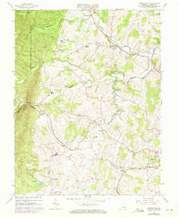
1964 Map of Churchville
USGS Topo · Published 1972About this map
Middle River and its winding tributaries, including Jennings Branch and Whisky Creek, define the rolling topography of this Augusta County landscape. Centered on the village of Churchville, the map captures a rural community organized around water crossings and long-standing local landmarks like Loch Willow Cem and Green Hill Cem. The western edge is dominated by the steep ascent of Little North Mountain within the George Washington National Forest, where Mc Kittricks Ridge rises sharply above the valley floor. Settlement patterns follow the lowlands, with small communities such as Lone Fountain and Swoope connected by the tracks of the Chesapeake And Ohio railroad. The presence of features like Trimbles Mill, a Quarry, and the High School near Buffalo Gap illustrates a local economy rooted in the intersection of natural resources, transport, and community infrastructure during the mid-1960s.
Find a feature on this map
46 named features on this map. Tap any name to fly to it.
Don’t see what you’re looking for? This feature index may not catch every label — zoom into the map to look around manually.
Map Details
Editions of this 1964 Churchville Map
4 editions found
Other maps of this area

1894 · Staunton
USGS Topo · 1:125,000

1924 · Mc Dowell
USGS Topo · 1:62,500

1943 · Craigsville
USGS Topo · 1:62,500

1944 · Parnassus
USGS Topo · 1:62,500

1944 · Mc Dowell
USGS Topo · 1:62,500

1944 · Staunton
USGS Topo · 1:62,500

1945 · Craigsville
USGS Topo · 1:62,500

1946 · Mc Dowell
USGS Topo · 1:62,500

1947 · Staunton
USGS Topo · 1:62,500

1947 · Parnassus
USGS Topo · 1:62,500