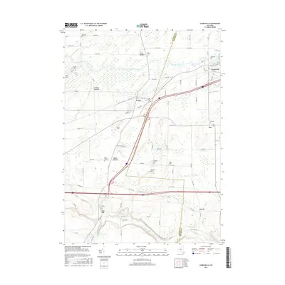
2016 Map of Churchville
USGS Topo · Published 2016About this map
Churchville and Bergen serve as the primary hubs in this agricultural and wetland landscape straddling the line between Genesee and Monroe counties. The northern portion is characterized by the expansive Byron-Bergen Swamp and the wandering course of Black Creek, while the southern reaches descend toward the waters of Oatka Creek near Buttermilk Falls. This 2016 survey documents a region where modern transportation corridors like the I-490 and New York State Route 33 intersect with traditional rural settlements such as Riga and Stone Church. Genealogists will find a high density of burial sites across the landscape, including the Stone Church Rural Cemetery and the Fort Hill Cemetery near the crossroads of Beulah. From the heights of Torpy Hill to the small village cluster at Jericon Corners, the map details a community defined by its watercourses and long-established local roads.
Find a feature on this map
90 named features on this map. Tap any name to fly to it.
Don’t see what you’re looking for? This feature index may not catch every label — zoom into the map to look around manually.
Map Details
Editions of this 2016 Churchville Map
This is the sole edition of this map. No revisions or reprints were ever made.
Other maps of this area

1897 · Albion
USGS Topo · 1:62,500

1899 · Brockport
USGS Topo · 1:62,500

1904 · Batavia
USGS Topo · 1:62,500

1904 · Caledonia
USGS Topo · 1:62,500

1932 · Spencerport
USGS Topo · 1:24,000

1934 · Spencerport
USGS Topo · 1:24,000

1934 · Brockport
USGS Topo · 1:24,000

1934 · Clifton
USGS Topo · 1:24,000

1935 · Churchville
USGS Topo · 1:24,000

1944 · Churchville
USGS Topo · 1:31,680