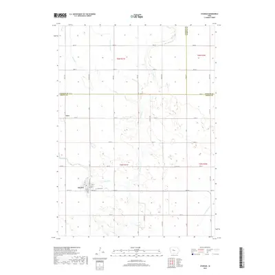
2018 Map of Churdan
USGS Topo · Published 2018About this map
Churdan sits as the primary hub in this corner of Greene County, where the grid of rural roads and section lines meets the natural drainage of the Iowa prairie. The landscape is defined by the winding course of Hardin Cr and its tributaries, including the aptly named Happy Run and Reading Cr. These waterways dictate the subtle variations in terrain across the quadrangle, which also includes the small community of Adaza to the northwest. To the east of the town center, Highland Cem serves as a significant landmark for local history and genealogical research. The map illustrates a highly organized agricultural region, where modern infrastructure like Co Hwy E19 and Co Hwy 18 E provides access to the surrounding townships and neighboring Calhoun and Webster counties.
Find a feature on this map
29 named features on this map. Tap any name to fly to it.
Don’t see what you’re looking for? This feature index may not catch every label — zoom into the map to look around manually.
Map Details
Editions of this 2018 Churdan Map
This is the sole edition of this map. No revisions or reprints were ever made.
Other maps of this area

1954 · Fort Dodge
USGS Topo · 1:250,000

1957 · Fort Dodge
USGS Topo · 1:250,000

1958 · Fort Dodge
USGS Topo · 1:250,000

1962 · Jefferson
USGS Topo · 1:62,500

1965 · Farnhamville
USGS Topo · 1:24,000

1965 · Gowrie
USGS Topo · 1:24,000

1980 · Wightman
USGS Topo · 1:24,000
1980 · Scranton
USGS Topo · 1:24,000
1980 · Lohrville
USGS Topo · 1:24,000
1985 · Carroll
USGS Topo · 1:100,000