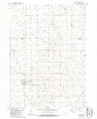
1985 Map of Churdan
USGS Topo · Published 1985About this map
Churdan anchors this mid-1980s landscape at the junction of Greene, Calhoun, and Webster counties. The map captures a transition in the local infrastructure, notably marking the Old Railroad Grade which once served as a primary transportation artery through Adaza and into the heart of town. This feature provides a clear trace for those researching the historical path of the rail lines that defined many small Iowa agricultural hubs.
Find a feature on this map
17 named features on this map. Tap any name to fly to it.
Don’t see what you’re looking for? This feature index may not catch every label — zoom into the map to look around manually.
Map Details
Editions of this 1985 Churdan Map
This is the sole edition of this map. No revisions or reprints were ever made.
Other maps of this area

1954 · Fort Dodge
USGS Topo · 1:250,000

1957 · Fort Dodge
USGS Topo · 1:250,000

1958 · Fort Dodge
USGS Topo · 1:250,000

1962 · Jefferson
USGS Topo · 1:62,500

1965 · Farnhamville
USGS Topo · 1:24,000

1965 · Gowrie
USGS Topo · 1:24,000

1980 · Wightman
USGS Topo · 1:24,000
1980 · Scranton
USGS Topo · 1:24,000
1980 · Lohrville
USGS Topo · 1:24,000
1985 · Carroll
USGS Topo · 1:100,000