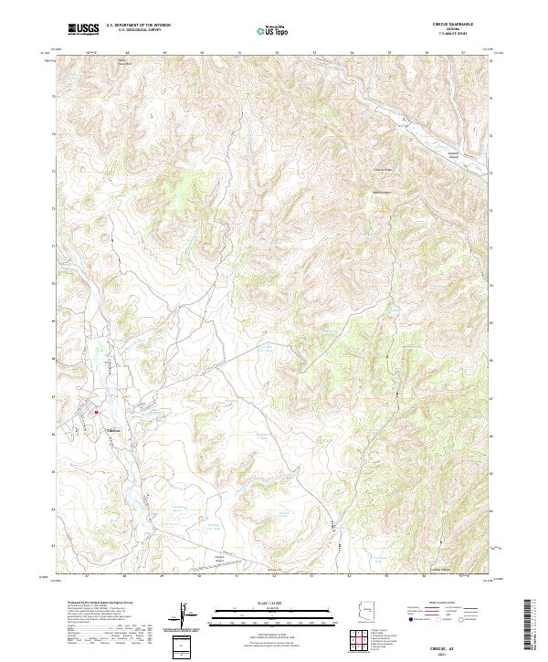
2021 Map of Cibecue
USGS Topo · Published 2021About this map
Cibecue serves as the central hub of this Arizona landscape, situated at the confluence of several key drainages in Navajo County. The settlement pattern follows the natural watercourses, with residential roads like W Cromwell Rd and N Tessay branching out near the banks of Cibecue Cr. This modern survey illustrates the vital importance of water management in the arid terrain, evidenced by numerous named tanks and springs, such as Ice Cream Cone Tank, Wildhorse Tank, and Cottonwood Spring.
Find a feature on this map
49 named features on this map. Tap any name to fly to it.
Don’t see what you’re looking for? This feature index may not catch every label — zoom into the map to look around manually.
Map Details
Editions of this 2021 Cibecue Map
This is the sole edition of this map. No revisions or reprints were ever made.
Other maps of this area

1886 · Holbrook
USGS Topo · 1:250,000

1893 · Holbrook
USGS Topo · 1:250,000

1922 · Chrysotile
USGS Topo · 1:125,000

1946 · Blue House Mtn
USGS Topo · 1:62,500

1951 · Blue House Mtn
USGS Topo · 1:62,500

1954 · Holbrook
USGS Topo · 1:250,000

1954 · Mesa
USGS Topo · 1:250,000

1957 · Mesa
USGS Topo · 1:250,000

1957 · Holbrook
USGS Topo · 1:250,000

1958 · Mesa
USGS Topo · 1:250,000