
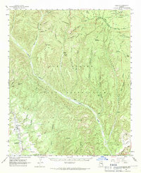
1961 Map of Cibecue
USGS Topo · Published 1963About this map
The Fort Apache Indian Reservation and Sitgreaves National Forest meet in this 1961 survey, documenting a rugged landscape of deep canyons and high ridges in Navajo and Gila Counties. The settlement of Cibecue serves as a focal point along Cibecue Creek, where social and educational foundations like the Apache Mission School and the Day School are established near the town center. Local history is etched into the terrain through names like Scott Cabin and a marked Cem, indicating the early 20th-century habitation and cultural layers of the region.
Find a feature on this map
55 named features on this map. Tap any name to fly to it.
Don’t see what you’re looking for? This feature index may not catch every label — zoom into the map to look around manually.
Map Details
Editions of this 1961 Cibecue Map
2 editions found
Other maps of this area

1886 · Holbrook
USGS Topo · 1:250,000

1893 · Holbrook
USGS Topo · 1:250,000

1922 · Chrysotile
USGS Topo · 1:125,000

1946 · Blue House Mtn
USGS Topo · 1:62,500

1951 · Blue House Mtn
USGS Topo · 1:62,500

1954 · Holbrook
USGS Topo · 1:250,000

1954 · Mesa
USGS Topo · 1:250,000

1957 · Mesa
USGS Topo · 1:250,000

1957 · Holbrook
USGS Topo · 1:250,000

1958 · Mesa
USGS Topo · 1:250,000