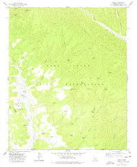
1977 Map of Cibecue
USGS Topo · Published 1978About this map
Fort Apache Indian Reservation encompasses this high-altitude landscape in the late 1970s, centered on the community of Cibecue. The settlement pattern follows the valley of Cibecue Creek, where social and educational life is anchored by the Cibecue Day Sch and the Apache Mission Sch. The map reveals a transition in local infrastructure, noting a Trailer Park, several cemeteries, and a Sewage Disposal Pond near the village center.
Find a feature on this map
41 named features on this map. Tap any name to fly to it.
Don’t see what you’re looking for? This feature index may not catch every label — zoom into the map to look around manually.
Map Details
Editions of this 1977 Cibecue Map
This is the sole edition of this map. No revisions or reprints were ever made.
Other maps of this area

1886 · Holbrook
USGS Topo · 1:250,000

1893 · Holbrook
USGS Topo · 1:250,000

1922 · Chrysotile
USGS Topo · 1:125,000

1946 · Blue House Mtn
USGS Topo · 1:62,500

1951 · Blue House Mtn
USGS Topo · 1:62,500

1954 · Holbrook
USGS Topo · 1:250,000

1954 · Mesa
USGS Topo · 1:250,000

1957 · Mesa
USGS Topo · 1:250,000

1957 · Holbrook
USGS Topo · 1:250,000

1958 · Mesa
USGS Topo · 1:250,000