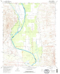
1965 Map of Cibola
USGS Topo · Published 1966About this map
The Colorado River serves as the central artery and state boundary in this mid-1960s survey, bisecting a landscape defined by desert washes and riparian conservation. To the east, the small settlement of Cibola sits at the foot of the Trigo Mountains, marked by a local Cem and proximity to the Cibola National Wildlife Refuge. The irrigation infrastructure of the Palo Verde Canal and various pumping stations reveal the region's agricultural dependency on the river, even as the surrounding terrain remains dominated by the Palo Verde Mountains and expansive desert reaches.
Find a feature on this map
20 named features on this map. Tap any name to fly to it.
Don’t see what you’re looking for? This feature index may not catch every label — zoom into the map to look around manually.
Map Details
Editions of this 1965 Cibola Map
3 editions found
Other maps of this area

1942 · Blythe
USGS Topo · 1:250,000

1945 · Cibola
USGS Topo · 1:62,500

1945 · Picacho
USGS Topo · 1:62,500

1951 · Picacho
USGS Topo · 1:62,500

1951 · Cibola
USGS Topo · 1:62,500

1952 · Mule Wash
USGS Topo · 1:24,000

1952 · Palo Verde
USGS Topo · 1:24,000

1953 · Palo Verde Mountains
USGS Topo · 1:62,500

1953 · Quartz Peak
USGS Topo · 1:62,500

1954 · Salton Sea
USGS Topo · 1:250,000