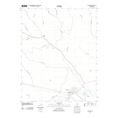
2010 Map of Cimarron
USGS Topo · Published 2010About this map
Cimarron serves as the focal point for this landscape where the Cimarron River meets several major canyon drainages. The settlement pattern reflects both ranching and extraction, anchored by the W S Ranch and the Cimarron Mine located near Compos Canyon. The northern half of the map is dominated by the intricate branching of Ponil Creek, including its North and South forks, which have carved numerous canyons such as McBride Canyon and Chase Canyon. This area holds significant historical depth, evidenced by the North Ponil Canyon Archaeological District situated just north of the town center. To the southeast, the French Lake Dam and French Lake provide a localized water management point near the confluence of several creeks. The terrain transitions from the high elevations of Antelope Mesa and Slate Hill in the southwest to the wide, label-rich canyon systems that define the northern boundary of the Colfax County region.
Find a feature on this map
35 named features on this map. Tap any name to fly to it.
Don’t see what you’re looking for? This feature index may not catch every label — zoom into the map to look around manually.
Map Details
Editions of this 2010 Cimarron Map
This is the sole edition of this map. No revisions or reprints were ever made.
Other maps of this area

1954 · Raton
USGS Topo · 1:250,000

1955 · Cimarron
USGS Topo · 1:62,500

1955 · Ute Park
USGS Topo · 1:62,500

1956 · Tooth Of Time
USGS Topo · 1:62,500

1956 · Miami
USGS Topo · 1:62,500

1958 · Raton
USGS Topo · 1:250,000

1981 · Springer
USGS Topo · 1:100,000

1981 · Raton
USGS Topo · 1:100,000

1982 · Wheeler Peak
USGS Topo · 1:100,000

1983 · Taos
USGS Topo · 1:100,000