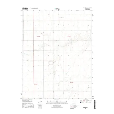
2016 Map of Cimarron NE
USGS Topo · Published 2016About this map
Buckner Cr carves a winding path across this portion of Gray County, defining the local topography where it cuts through the Kansas plains. This 2016 survey illustrates the organized rural grid system that facilitates agricultural activity in the High Plains. The landscape is structured around a network of section lines and designated routes such as Co Rd 19 and Co Rd 21, which provide access to the vast open fields and seasonal wetlands. The map spans the boundaries of t24s r28w and t24s r27w, showing how water drainage patterns influence the placement of local roads and property divisions. This documentation is particularly useful for understanding the modern footprint of land management in an area where the hydrology of the creek remains the primary natural landmark.
Find a feature on this map
18 named features on this map. Tap any name to fly to it.
Don’t see what you’re looking for? This feature index may not catch every label — zoom into the map to look around manually.
Map Details
Editions of this 2016 Cimarron NE Map
This is the sole edition of this map. No revisions or reprints were ever made.
Other maps of this area

1892 · Dodge
USGS Topo · 1:125,000

1955 · Dodge City
USGS Topo · 1:250,000

1955 · Scott City
USGS Topo · 1:250,000

1958 · Dodge City
USGS Topo · 1:250,000

1958 · Scott City
USGS Topo · 1:250,000

1959 · Dodge City
USGS Topo · 1:250,000

1968 · Cimarron NW
USGS Topo · 1:24,000

1968 · Ingalls
USGS Topo · 1:24,000

1968 · Dodge City NW
USGS Topo · 1:24,000

1968 · Cimarron
USGS Topo · 1:24,000